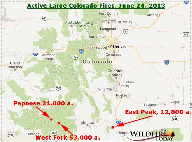
Map of Colorado Fires, June 24, 2013: The map shows the large fires that are still active and spreading in Colorado. We did not show the Windy Pass Fire, but it is adjacent to the West Fork Fire and has burned about 1,250 acres. More...
This is only the beginning of the article. Visit WildfireToday.com to read the rest.


Aucun commentaire:
Enregistrer un commentaire
Vous pouvez mettre un commentaire en lien avec cet article.
Tout commentaire hors sujet ou ayant un caractère qui sera jugé mal placé sera supprimé.